
Oceanic#
oceanic loads or declares sea-level information for coastal boundary
conditions and coastal project context. It is separate from meteorological
forcing because its downstream role is usually a boundary stage or a controlled
coastal reference level.
Accepted sources#
Source |
Use when |
Source page |
|---|---|---|
|
Local sea-level files are authoritative. |
|
|
SHOM observations should be discovered or retrieved. |
|
|
A controlled fixed sea level is enough for the case. |
|
Minimal example#
[data.oceanic]
date_start = "2020-01-01"
date_end = "2020-12-31"

[[data.oceanic.sources]]
source = "constant"
value = 0.0
Checks#
Confirm whether values represent absolute sea level, anomaly, or model-stage convention.
Keep vertical datum assumptions explicit.
For SHOM or custom time series, check station location, date coverage, and units before the data are mapped to a boundary condition.
Local deterministic run#
The repository includes a small local oceanic case under
hydromodpy/data/variables/oceanic/cases. It is not a coastal basin study;
it is a communication and regression asset that proves the custom source can be
loaded, summarized, and plotted without requiring network access.
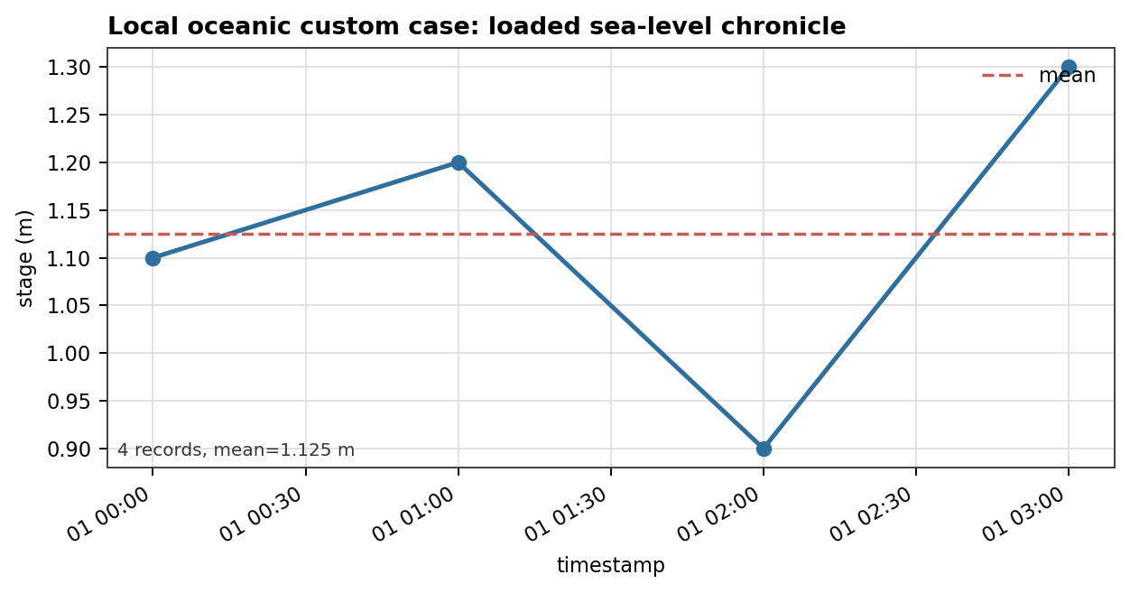
Fig. 175 The figure shows the loaded stage values and the returned mean sea level
used by the data-only case. This is the minimum useful visual contract for
custom oceanic data: timestamps, values, units, and summary level are
visible.#
Remaining gallery gap#
The current Nancon reference is inland, so it is not the right practical case for oceanic data. A future gallery case should use a coastal basin and show the station or boundary-stage chronicle directly on the oceanic pages.
Oceanic Source: constant#
Use source = "constant" for controlled examples, inland tests that need a
neutral oceanic placeholder, or coastal sensitivity studies with a fixed stage.
Minimal example#
[[data.oceanic.sources]]
source = "constant"
value = 0.0
Operational checks#
State the vertical datum represented by
value.Keep the value in the same conceptual convention as the boundary condition that will consume it.
Do not treat a constant source as an observation; it is a controlled input.
Oceanic Source: custom#
Use source = "custom" when project-owned sea-level or coastal-stage files
should be authoritative.
Minimal example#
[[data.oceanic.sources]]
source = "custom"
path = "data/oceanic/sea_level.csv"
col_datetime = "date"
col_value = "stage"
source_unit = "m"
Operational checks#
Document vertical datum and sign convention.
Check station or boundary location.
Confirm date coverage before a transient coastal boundary consumes the data.
Oceanic Source: shom#
Use source = "shom" when SHOM sea-level observations should be discovered
or downloaded for a coastal project.
Minimal example#
[[data.oceanic.sources]]
source = "shom"
extent = "study_area"
nearest = true
Operational checks#
nearestcan help select a usable tide-gauge station near the study area.fallback_search_radius_kmshould be documented when it changes station selection.Preserve cache and lockfile metadata for reproducibility.
Always record the vertical datum assumption before mapping values to a boundary stage.
Provider replay#
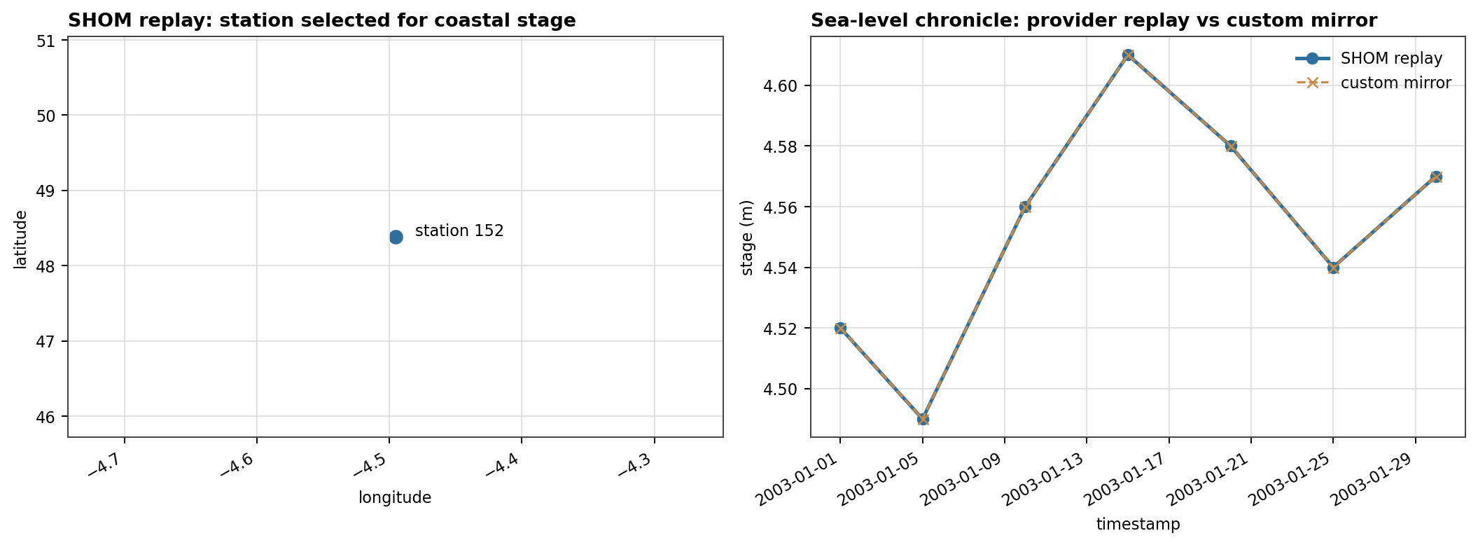
Fig. 176 This replay uses committed sample artifacts rather than a live SHOM request. It shows the two checks that a future coastal gallery case should keep on the same page: station selection and boundary-stage chronicle.#